Today marks the end of the Atlantic Hurricane Season and Belize once again counts its blessings and island residents give thanks to God for being spared once again from those deadly storms. Tropical Storm Harvey in early August impacted southern Belize and sprung a tornado that ripped through the village of Crooked Tree for just a few minutes; very rare here in Brelize.
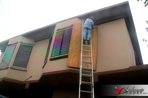
Hurricane Rina, in October came too close to comfort towards the northern part of the country and managed to disrupt normal life in both the islands of Ambergris Caye and Caye Caulker which issued voluntary evacuations, that quite a few island residents heeded. Its effect was felt with costly shut down of business hours, lost revenues in tourism and costly evacuations during an already slow tourism season.
NOAA has issued its release summarizing the 2011 hurricane season: “Active 2011 hurricane season breaks “Hurricane Amnesia”. The 2011 Atlantic hurricane season produced a total of 19 tropical storms of which seven became hurricanes, including three major hurricanes. Read NOAA’s report below.


Active 2011 hurricane season breaks ‘Hurricane Amnesia’
Irene the first hurricane to hit U.S. in three years; Northeast reminded it’s also vulnerable
The 2011 Atlantic hurricane season officially ends Wednesday, having produced a total of 19 tropical storms of which seven became hurricanes, including three major hurricanes. This level of activity matched NOAA’s predictions and continues the trend of active hurricane seasons that began in 1995.
The 19 tropical storms represent the third-highest total (tied with 1887, 1995, and 2010) since records began in 1851 and is well above the average of 11. However, the number of hurricanes and major hurricanes is only slightly above the average of six and two, respectively. This year’s totals include a post-storm upgrade of Tropical Storm Nate to hurricane status, and the addition of a short-lived, unnamed tropical storm that formed in early September between Bermuda and Nova Scotia. This unnamed storm, along with several other weak, short-lived named storms, could have gone undetected without modern satellite technology.
Irene was the lone hurricane to hit the United States in 2011, and the first one to do so since Ike struck southeast Texas in 2008. Irene was also the most significant tropical cyclone to strike the Northeast since Hurricane Bob in 1991.
“Irene broke the ‘hurricane amnesia’ that can develop when so much time lapses between landfalling storms,” said Jack Hayes, Ph.D., director of NOAA’s National Weather Service. “This season is a reminder that storms can hit any part of our coast and that all regions need to be prepared each and every season.”
As far as landfalling major hurricanes (Category 3, 4 or 5 with top winds of 111mph and greater) are concerned, the lull continues. 2011 marks a record six straight years without one hitting the United States. The last one to do so was Wilma in 2005. Nonetheless, wind is not the only threat with tropical systems as proven by Irene and Lee, which caused deadly and destructive flooding. On average, more than half of the fatalities related to tropical systems are due to flooding.
Hurricane Irene is an example of increasing accuracy in forecasting storm track. Its landfall in eastern North Carolina and path northward were accurately predicted more than four days in advance by NOAA’s National Hurricane Center using information from weather satellites, hurricane models, aircraft observations, and other data. NOAA’s delivery of critical environmental forecasts provided essential advance information that allowed emergency officials to plan necessary evacuations and sparked individuals to take safety precautions. But a weaker-than-anticipated Irene at landfall also highlighted the challenges that remain in forecasting storm intensity.
“Improving intensity forecasts is a focus of ongoing research and is part of NOAA’s Hurricane Forecast Improvement Project,” said Frank Marks, Ph.D., director of NOAA’s Hurricane Research Division. HFIP bridges research and operational components to better anticipate rapid changes in storm intensity and its goal to extend track forecasts from the current five days to seven days.
“Although the 2011 hurricane season has ended, our need to prepare for disasters hasn’t,” said Craig Fugate, administrator of the Federal Emergency Management Agency. “Being prepared for all kinds of hazards, from hurricanes to blizzards to tornadoes, is a year-round activity. We encourage all members of the team, especially the public, to continue to prepare for emergencies by staying informed of forecasted weather events, making an emergency plan, and building your emergency preparedness kit. Visit Ready.gov to learn more.”
NOAA will issue its initial outlook for the 2012 hurricane season in May just prior to the official start of the season on June 1.
NOAA’s National Weather Service is the primary source of weather data, forecasts and warnings for the United States and its territories. NOAA’s National Weather Service operates the most advanced weather and flood warning and forecast system in the world, helping to save lives and livelihoods and enhance the national economy. Working with partners, NOAA’s National Weather Service is building a Weather-Ready Nation to support community resilience in the face of increasing vulnerability to extreme weather. Visit us online at weather.gov and join us on Facebook, Twitter and our other social media channels.
NOAA’s mission is to understand and predict changes in the Earth’s environment, from the depths of the ocean to the surface of the sun, and to conserve and manage our coastal and marine resources. Join us on Facebook, Twitter and our other social media channels.